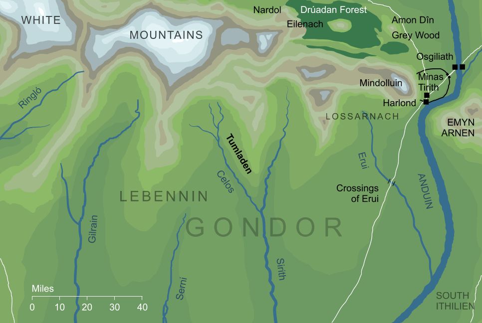
That is, the name does not appear on any canonical map. As mentioned in note 2 above, it is shown on Pauline Baynes' illustrated map of Middle-earth, and following Tolkien's own diagram, the label 'Tumladen' appears in the triangle of land between the rivers Celos and Sirith on the northeastern borders of Lebennin. This position also matches at least relatively well with the relevant entry in Tolkien's detailed index to The Lord of the Rings, where Tumladen is described as the 'flatlands at east of Lebennin'.
On this basis, the placing of Tumladen seems fairly conclusive, but actually this northerly position is difficult to square with a specific textual reference. While talking to Pippin, Beregond explains that the southward road from Minas Tirith goes to (among other places) the vale of Tumladen. The mapped location of the vale, however, places it very far from that road indeed - perhaps some fifty miles even at its nearest point. On that basis, it might be that the name Tumladen didn't refer exclusively the triangular vale between the rivers Celos and Sirith, but also extended somewhat farther southward until it approached the southern road of Gondor.
|