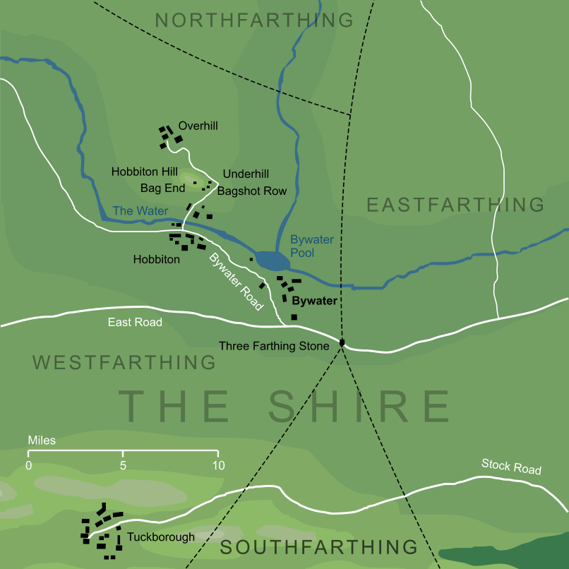
Bywater and the surrounding region1
Bywater and the surrounding region1
A town or village of the Shire, lying close to Hobbiton on the borders of the Westfarthing, near the East Road.
Notes
1 |
The map shown here follows the large-scale map of the Shire published in The Lord of the Rings, but it should be noted that Tolkien did not appear to consider that map completely canonical. In late notes reproduced in The History of Hobbit, he says that 'in that map Bywater and its pool are somewhat too far east'. According to those notes, Bywater lay much more nearly southward of Hobbiton, with just a mile and a quarter between Hobbiton's road junction and the northernmost dwellings of Bywater (including the Green Dragon inn). These comments fit the text rather more easily, for instance making the Green Dragon much more accessible to the Hobbits of Hobbiton who evidently frequented it, but for consistency we maintain the standard map layout here. |
See also...
Better Smials, Bywater Pool, Bywater Road, Cotman, Cotton Family, Folklands, Four Farthings, Green Dragon, Halfast ‘Hal’ Gamgee, Hobbiton Road, Holman Cotton (‘Long Hom’), ‘Long Hom’, Mrs. Lily Cotton (née Lily Brown), Oatbarton, Old Noakes, [See the full list...]Pool Side, Postmaster, Sharkey’s End, South Lane, The Ivy Bush, The Pool, The Water, Three-Farthing Stone, Water-valley, Wilcome ‘Will’ Cotton
Indexes:
About this entry:
- Updated 21 July 2015
- Updates planned: 1
For acknowledgements and references, see the Disclaimer & Bibliography page.
Original content © copyright Mark Fisher 1998, 2001, 2011, 2015. All rights reserved. For conditions of reuse, see the Site FAQ.

